Yuanyang’s Hani terraces: Duoyishu, Azheke and Bada with a workable overnight plan
Pair two named terrace viewpoints with a village visit that explains the living landscape. This Yuanyang guide covers the agricultural season, predawn transport, the Azheke community context and a relaxed Bada finish, using real photographs of the exact places rather than unrelated rice-field stock.
Build the trip around a working landscape
The Honghe Hani Rice Terraces are a cultural landscape in southern Yunnan, not a single field beside a car park. UNESCO identifies an interdependent system of forest, villages, water channels and cultivated terraces. This route concentrates on the Yuanyang area, pairing the named viewing areas of Duoyishu (多依树) and Bada (坝达) with an interpreted village visit at Azheke (阿者科). The aim is to understand both the large-scale view and the work and settlement that sustain it.
Allow an overnight stay if dawn or late light matters to you. Ask your host for its actual position relative to the chosen viewpoints and Xinjie (新街), the old town named in the prefecture's destination guide. A booking labelled Yuanyang does not by itself establish a convenient predawn departure. If you have only a short daytime visit, choose one viewpoint and Azheke instead of spending the entire day moving between platforms. The landscape is worthwhile without achieving both a celebrated sunrise and a dramatic sunset.
Choose the agricultural season, then accept the weather
A recent county-hosted field report describes November through April as the usual water-filled season, while the summer visit material shows green growing terraces. Use this distinction when choosing the experience you want: water and reflections, growing rice or the changing appearance around harvest and preparation. Exact field conditions depend on the agricultural calendar and location, so ask what is happening near the specific viewpoint close to your travel date. One famous mirror-like image does not describe the fields throughout the year.
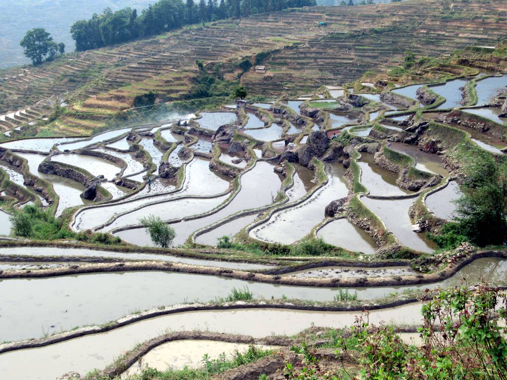
The lead photograph is genuinely Duoyishu in April 2019. The Bada and Azheke photographs were taken in December 2025. Together they show real terrace form and differing light and water appearance, without promising a matching sky. Mist may obscure the broad view rather than enhance it. If the forecast is poor, keep a village interpretation and a flexible viewpoint block instead of paying for a tightly timed photography circuit whose whole value depends on a brief break in cloud.
Duoyishu: arrange the early start before going to sleep
The prefecture's tourism authority identifies Duoyishu with sunrise views. If that is your priority, confirm the current opening arrangements, the actual departure time from your accommodation, the exact drop-off and the driver's waiting or return plan the previous evening. Sunrise changes through the year; do not copy a fixed clock time from an old itinerary. Ask what happens if road conditions or visibility make the outing impractical. Keep a warm layer and a small light available for the permitted approach if you will arrive before daylight.
At the viewing area, find a lawful position that leaves the circulation clear. Begin with the whole slope, then notice how individual plot edges adjust around the ground rather than forming a uniform grid. Look for the relation between water level, bunds and the larger contour, while leaving technical irrigation claims to an interpreter. Tripods and long lenses do not give a visitor priority over the public edge. When cloud blocks the view, allow a reasonable wait, then follow the agreed plan rather than climbing beyond the platform for a supposedly clearer angle.
References: 2
Azheke: make the village visit part of the explanation
After breakfast and a rest, visit Azheke through its actual visitor arrangements. The county government's account describes a village collective tourism company established through the Azheke Plan with local participation. Use the responsible village service for the current admission and an available guide, rather than assuming the village is an open film set or that a guide quoted online is operating today. Ask for an explanation that connects the houses, paths, water and cultivation. That is a different contribution from another wide-angle terrace photograph.
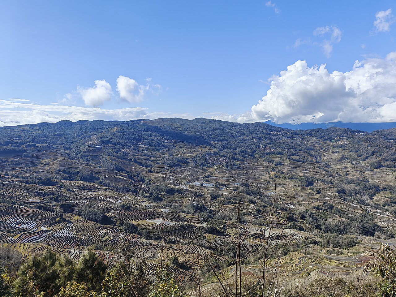
Walk only public or explicitly permitted lanes. Ask before entering a dwelling or photographing people closely. A thatched ‘mushroom house’ is someone's building with practical needs, not just an object that must remain visually unchanged for tourists. If a guide identifies a water-distribution feature or an agricultural path, ask how it is used and maintained. Do not divert water, remove a stone or walk a narrow field edge to test the explanation. The photograph from Azheke depicts the actual surrounding terrace landscape; it is not passed off as a photograph of a house interior.
Bada: leave time to see the scale before the late-light wait
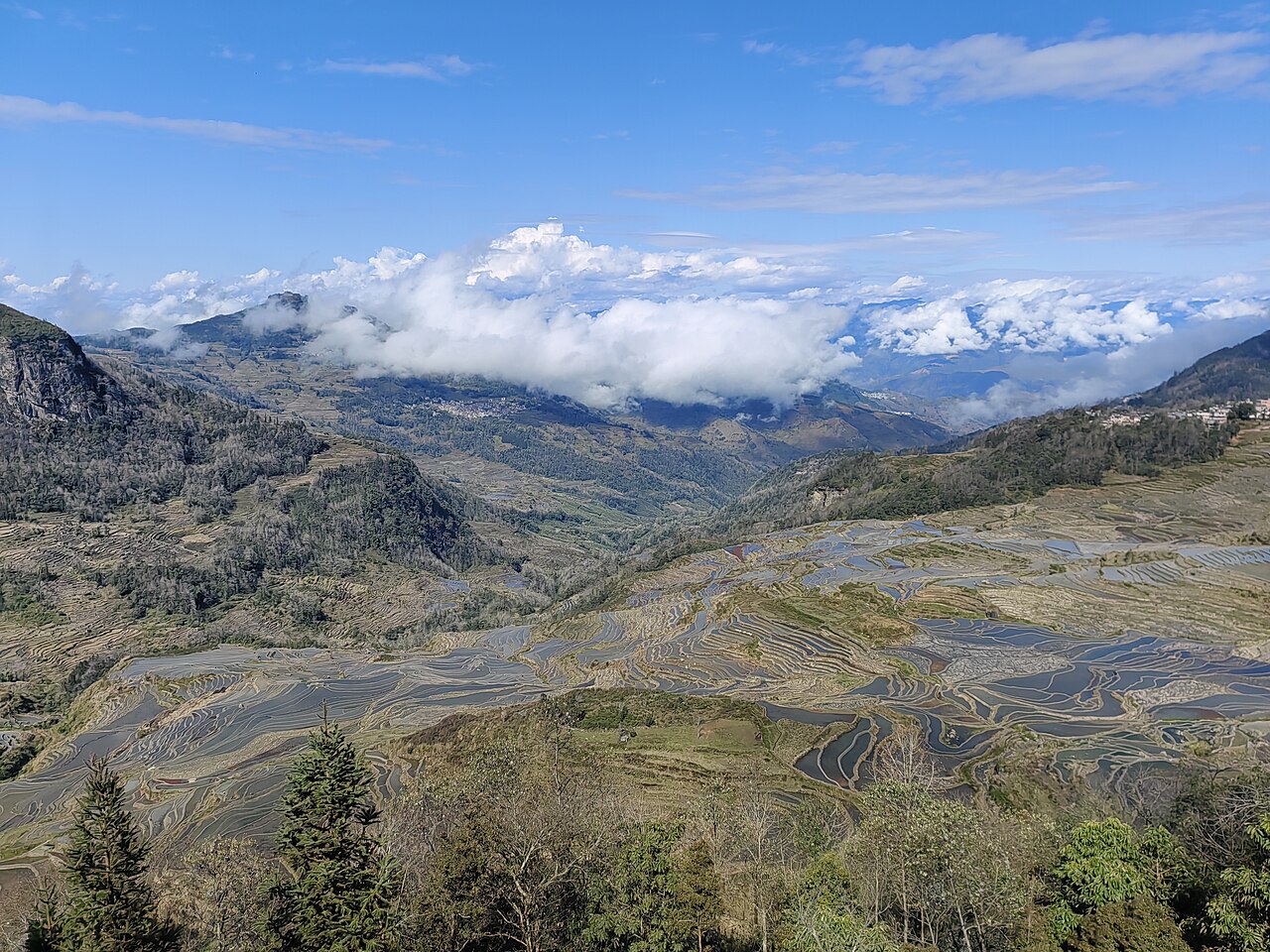
Continue to Bada after a proper meal and the confirmed transfer. The prefecture's destination description identifies it as a broad terrace viewing area associated with sunset and a number of village-linked slopes. Arrive with enough daylight to understand that scale rather than treating it only as a final-minute place to point a camera toward the sun. The supplied December 2025 image shows the real Bada panorama in ordinary afternoon light, including large differences in visible water and cultivation across the slopes.
Choose one broad view and a closer section of the terraces to compare. Look at how the land links the foreground to distant villages and forested areas; do not assume every roof or path in the distance is on an accessible visitor circuit. If you stay for late light, keep the confirmed return arrangement and a clear meeting point. A driver cannot necessarily identify you from a photograph of the entire hillside. If weather worsens, finish while the permitted path and transport remain straightforward rather than protecting a sunset promise the landscape never made.
Keep access, transport and walking separate in the budget
Before the first paid stop, confirm the current named viewpoint product, its validity and any separate village charge or guided service. This research verified the places and their differing roles but did not establish a complete live operator price list, so none is invented. A private vehicle, an admission ticket and a village guide are distinct services unless the actual booking states otherwise. Ask a driver what waiting, route changes and the final return include, and save the agreement where you can find it without a network connection.
Ask about the actual surfaces and steps at each viewing area if anyone needs assistance. Keep the walk manageable after an early start, carry water and plan toilets and food instead of assuming every stop provides them. Farm paths are not automatically tourist hiking trails. If you want a guided walk through cultivation areas, arrange an appropriate local route and permission; do not infer a safe connection between two viewpoints from a map line or the apparent closeness of terraces in a photograph.
Make a useful day even when one view disappears
Keep two versions of the day. In clear conditions, retain Duoyishu, the Azheke explanation and Bada with a relaxed meal break. In persistent cloud or rain, shorten the exposed viewpoint time and concentrate on the confirmed village visit and an interpreted introduction to the landscape. If a named stop is closed, choose a verified alternative with the local service; an old destination page is not permission to cross a closure. Do not add another distant viewpoint merely to keep the stop count unchanged.
Before leaving, try explaining why a terrace panorama includes more than its curved lines. The forested catchment, channels, settlements and cultivation are connected, while the people maintaining them continue to live and work here. A respectful visitor pays for an agreed service, leaves working ground intact and captions the actual viewpoint. That understanding survives an ordinary sky and a changed season. It also makes the photographs useful to the next traveller instead of presenting a visually perfect moment as a guaranteed product.
References: 1
An overnight shape with room to adapt
Arrive and settle the transport and admission questions before the photography morning. The following day, use Duoyishu early if conditions and access permit, return for breakfast, give Azheke an unhurried late-morning block, take a proper lunch break and finish at Bada. Keep the actual transfers and return journey separate from sightseeing time. In poor weather, preserve one interpreted village visit and one suitable viewpoint instead of pursuing every stop.
Questions
Must I visit at sunrise?
No. Duoyishu is associated with sunrise in the authority’s destination guide, but the terraces are a working cultural landscape throughout the day. A clear daytime view plus a well-explained village visit can be more rewarding than an exhausted morning in opaque mist.
Can I walk directly through the fields between viewpoints?
Do not assume so. Arrange a permitted local route if that is your interest. Narrow bunds, water channels, working plots and changing ground conditions should not be treated as an improvised tourist trail.
Sources and photography
- UNESCO: Cultural Landscape of Honghe Hani Rice Terraces
- Honghe Culture and Tourism Bureau: Yuanyang Hani Terraces
- Yuanyang county-hosted contemporary field report, October 2026
- David Stanley: Duoyishu Rice Terraces
- Yumeto: Bada Rice Terraces
- Yumeto: Azheke terrace landscape
- Yuanyang county government: Azheke village collective tourism report
Photographs are credited beside each image. Their recorded capture dates describe the images; check the current visitor or product information linked above when planning.